Hardin, MT
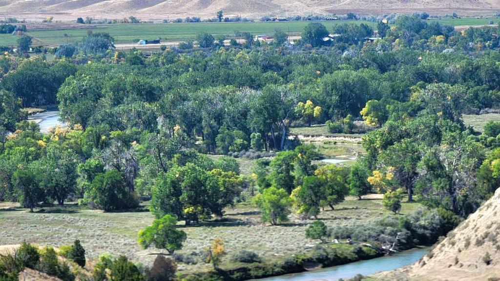
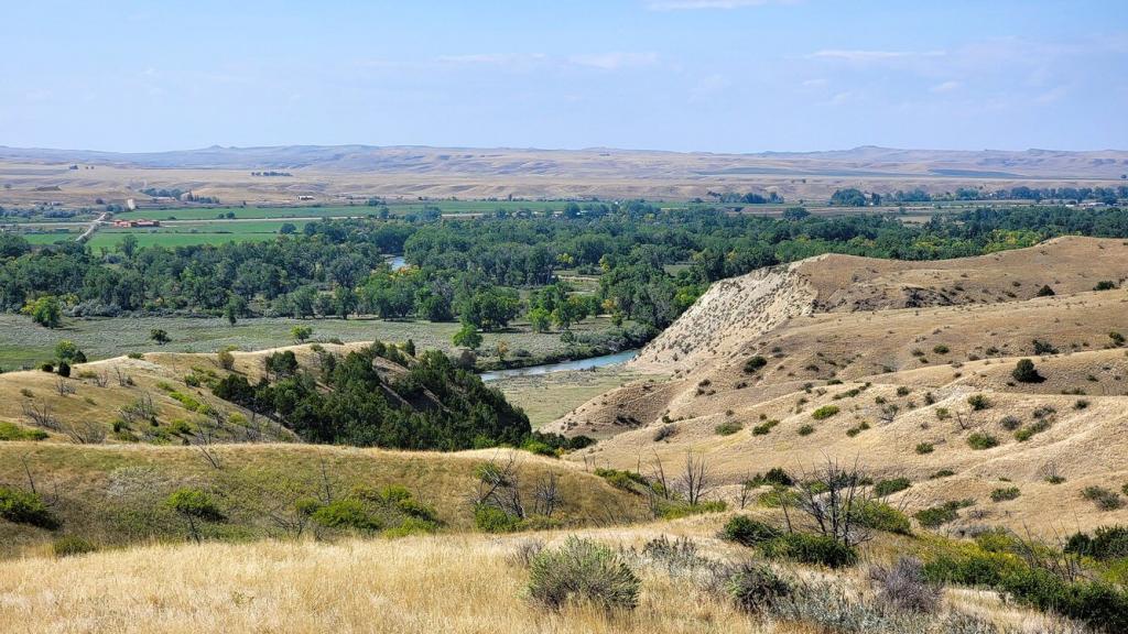
Hardin is a small town of about 3500 people in south eastern Montana. It was incorporated in 1911 and Thomas D. Campbell operated the nation’s largest wheat farm on 95,000 acres near there while pioneering the use of industrial machinery in farming. The Holly Sugar Company also established a sugar beet–processing plant in Hardin in 1937. Interestingly, with Hardin being in the middle of nowhere, Bitcoin miner Marathon apparently has a large mining operation in Hardin today because of low cost coal fired power generation nearby. With efforts to close down the coal fired plant, solar is being built to replace the coal. So what was the draw here for us? The Little Bighorn Battlefield is about 15 miles south of Hardin.
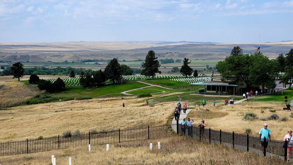
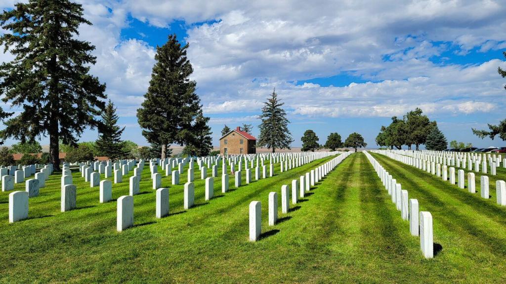
Little Bighorn Battlefield National Monument
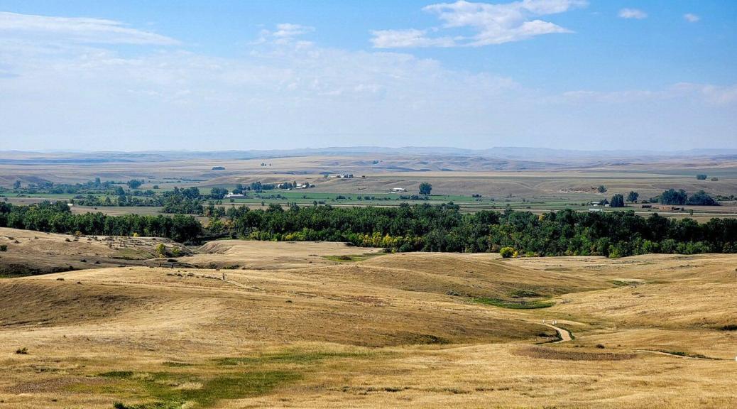
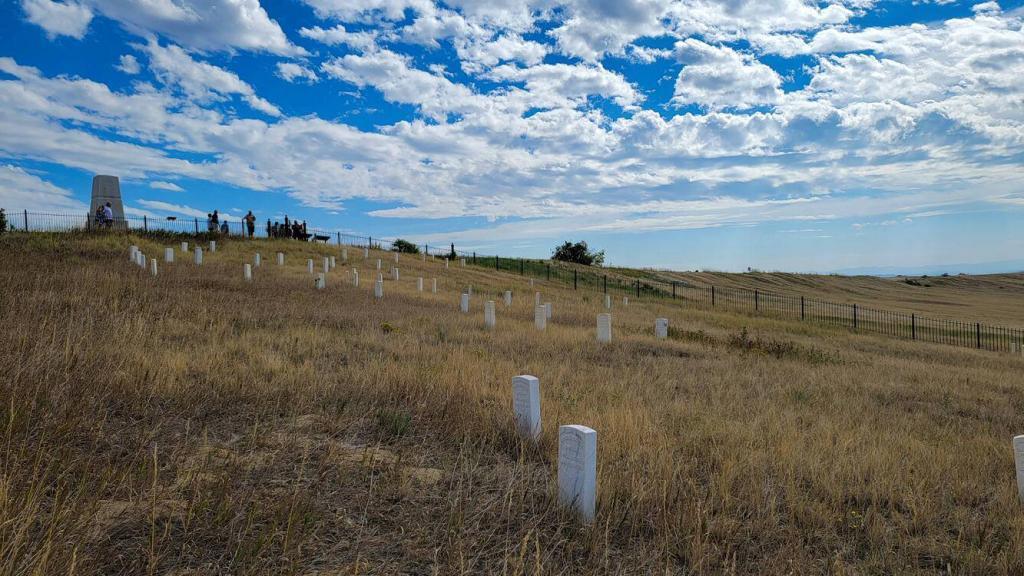
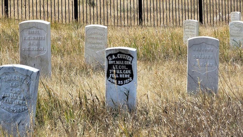
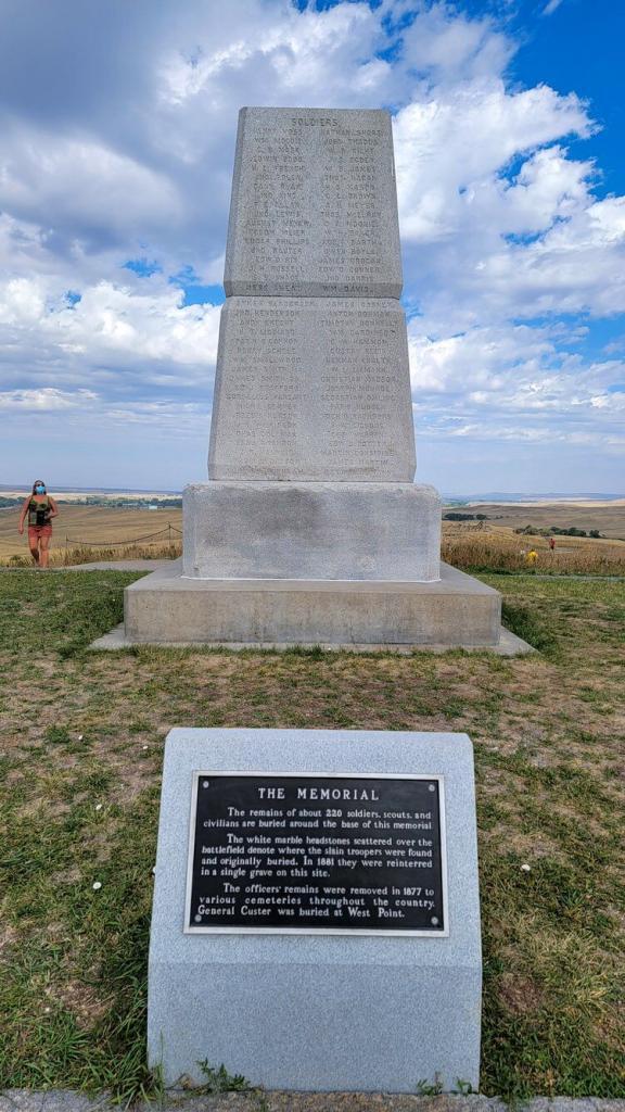
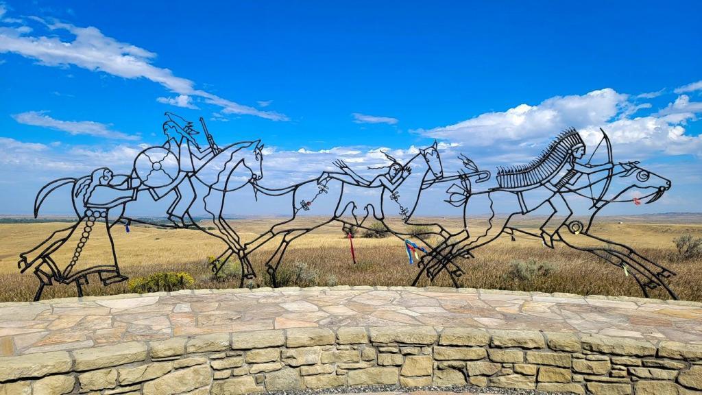
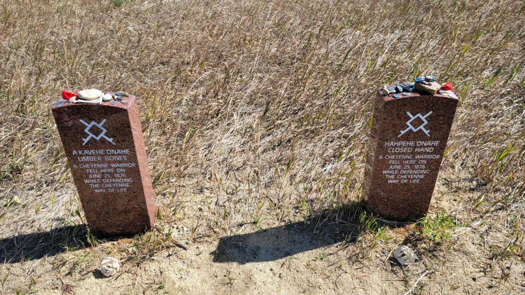
The Battle of the Little Bighorn, known to the Lakota and other Plains Indians as the Battle of the Greasy Grass and also commonly referred to as Custer’s Last Stand, was an armed engagement between combined forces of the Lakota, Northern Cheyenne, and Arapaho tribes and the 7th Cavalry Regiment of the United States Army. The Little Bighorn Battlefield National Monument memorializes one of the last armed efforts of the Northern Plains Indians to preserve their ancestral way of life. Here more than 260 soldiers of the U.S. Army met defeat and death at the hands of several thousand Lakota and Cheyenne warriors. Among the dead were Lt. Col. George Armstrong Custer and every member of his immediate command. Although the Indians won the battle the Indian chiefs understood that they would lose the war as the military efforts to contain them would never end.
In 1876, the Battle of the Little Bighorn was only the latest encounter in a centuries-long conflict that began with the arrival of the first Europeans in North America. These conflicts reached their peak following the Civil War when settlers resumed their vigorous westward movement. The Indians’ resistance only intensified the hostilities.
In 1868 believing it was “cheaper” to feed than fight the Indians,” the U.S. government signed a treaty at Fort Laramie, WY with the tribes of the Great Plains giving them much of eastern Wyoming as a permanent reservation. Within 6 years however, gold was discovered in the Black Hills in the heart of the new reservation and eager gold seekers swarmed into the region in violation of the treaty. The army tried unsuccessfully to keep them out. The government also tried to buy the Black Hills from the Indians but that proved unsuccessful as well. In defiance the Lakota and Cheyenne left the reservation and resumed raids on settlements and travelers. In December 1875, the commissioner of Indian Affairs ordered the tribes to return to the reservation before January 31 1876 or be treated as hostiles. When the Indians did not comply, the army was called in to enforce the order thus setting up the eventual Battle of the Little Big Horn.
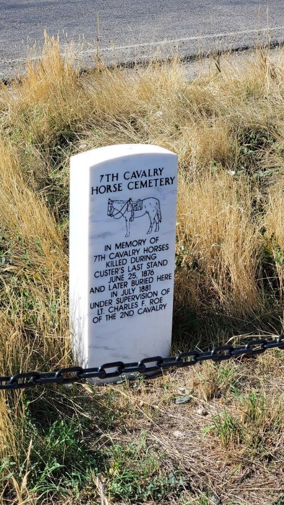
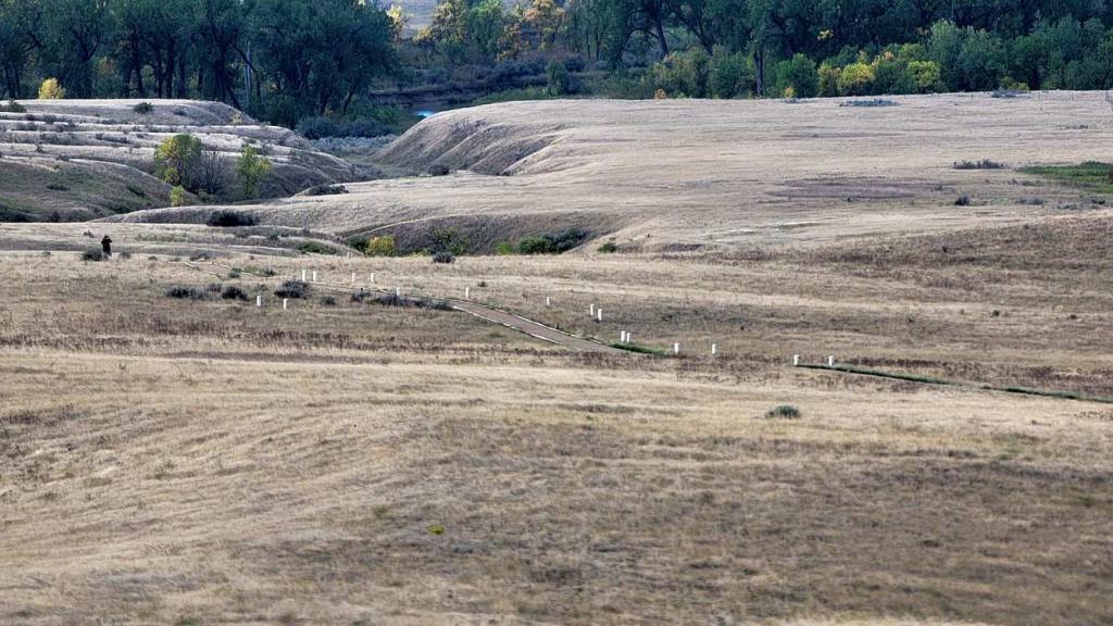
The 7th Calvary, numbering about 600 men, located the Indian camp at dawn on June 25’th 1876. Custer likely underestimated the size and fighting power of the Indians and also believed they would likely flee when attacked, divided his regiment into three battalions. Custer retained five companies of men and assigned three companies each to Maj. Marcus A. Reno and Capt. Frederick W. Benteen.
Benteen was ordered to scout the bluffs to the south, while Custer and Reno headed toward the Indian camp in the valley of the Little Bighorn. When near the river, Custer turned north toward the lower end of the encampment. Reno was ordered to cross the river and attack, and he advanced down the valley to strike the upper end of the camp. A large force of Lakota warriors rode out and attacked forcing him to retreat and take up a defensive position on the bluffs beyond the river. Here he was joined by Benteen who had hurried forward under orders from Custer.
No one knew precisely where Custer and his command had gone, but heavy gunfire to the north indicated he had also come under attack. Reno and Benteen quickly moved their troops northward to a high hill (afterwards named Weir Point) overlooking the area now known as Custer battlefield. By now the firing had stopped and nothing could be seen of Custer and his men. Then a large force of Indians attacked the soldiers on Weir Point and Reno had to order a withdrawal back to the bluffs overlooking the Little Bighorn. Here the seven companies held their defenses throughout the rest of the day and most of the next until the siege ended with the Indians finally withdrawing as more troops approached.
Park Review – Grandview Campground & RV Park
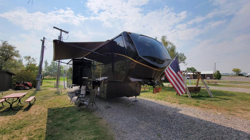
Rating: ⭐⭐
Site Quality / Amenities: The main road into the park is asphalt, the remaining roads and sites are gravel. There is a picnic table at each site. Store and gift shop on site. Minimal game room. Laundry, rest rooms and showers.
Type: Commercial
Access: South of Interstate 90 on Montana 313 (N. Mitchell Ave).
Staff: The staff were friendly and helpful.
Cellular/Wi-Fi: Both AT&T and Verizon had fast download speeds of 30 to 60 Mbps depending on the time of day with 5-10 Mbps upload speeds. Wi-Fi was available but we did not use it.
Restaurants: There are several fast food restaurants in town as well as a Pizza Hut. Beyond that, most remaining restaurants are either sandwich shops or casino’s with a small restaurant inside.
Nearby parks: Many people recommend the 7th Ranch RV Camp about 6 miles south of the battlefield near Garryowen, MT. It is newer and seems to have nice sites but without many amenities. Unfortunately there is no where to get diesel without travelling back to Hardin. UPDATE: We did find out that diesel is available just outside the gate to the battlefield. There is also a Hardin KOA Journey but Grandview looked a bit nicer and was less expensive. We didn’t drive through either of these.
What we liked: Friendly owner and camp staff. Large pull through sites that are 120′ long and quite wide. Nightly ice cream socials for $3 per person.
What we didn’t like: The park needs some clean up, mostly with regard to the owner’s property. It wasn’t horrible but could have been improved. Given the owner’s new businesses I’d be concerned that the park may further deteriorate going forward. Bighorn Canyon National Recreation Area is a recommended must see but you really can’t get to the canyon from Hardin. You probably need to be south of the area in Wyoming.
Verdict: We’d stay here again for a day or two if we were in the area and nothing else was available. The 7th Ranch RV Camp would likely be better if not a bit more difficult to get to. We did find out there is a station with diesel just outside the gate of the Little Bighorn Battlefield.
One thought on “Hardin, MT”
You guys are having such a great trip this year! Hoping we can visit some of these places next year.